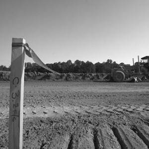
We consistently invoke unique approaches using the latest technologies to provide quality and timely services, no matter the size of the project. Wilhite Surveying utilizes a wide range of onsite and office tools, including the 3-D laser scanner, Global Positioning System (GPS), electronic distance meters, and the latest software including Carlson Survey with AutoCAD© .

Innovative & Reliable
Wilhite Surveying LLC
Provides a diverse range of land surveying services for both public and private sectors.

Boundary Surveys
Boundary surveys are surveys made to establish or reestablish property boundary lines on the ground or to obtain data for making a map showing boundary lines. These surveys include residential lots, commercial property and large acreage tracts.

Construction Surveys
Construction surveys are survey measurements on a construction project to control position, dimensions, and configuration.

Elevation Certificate
This type of survey determines the elevation of various sections of a building or land. The Elevation Certificate is an important administrative tool of the National Flood Insurance Program (NFIP). It is to be used to provide the elevation information necessary to ensure compliance with community floodplain management ordinances, to determine the proper insurance premium rate, and to support a request for a Letter of Map Amendment (LOMA) or a Letter of Map Revision based on fill (LOMA-F).

Mortgage or Title Surveys
These are surveys made for lending or insuring agencies to evaluate title problems, if any, relating to actual occupation and possession.

Topographical Surveys
This type of survey locates natural features such as elevations, land contours, trees, streams, etc. This type of land surveying may be required by a government agency, or may be used by engineers or architects for the design of improvements or developments on a site.

Location Surveys
Location surveys are not boundary surveys. These surveys are typically used by title companies and mortgage lenders to obtain proof that the major improvements on the property are free of encroaching onto neighboring properties and into recorded easements. Fences and other improvements should not be constructed based on a location survey. This is because boundary lines are not determined.

Subdivision Surveys
Surveys dividing undeveloped areas of land into blocks, lots, streets, parks, etc., in conformance with governing ordinances. This procedure includes platting, segregations, and other divisions not exempt from subdivision ordinances.

Lot Split
These types of surveys are needed when one may need to divide an existing parcel of land into two or more parcels. Site Plan A combination of a boundary and topographical survey are used for the preparation of a site plan when designing improvements or developments or obtaining government building permits.
Wilhite Surveying: Who We Are
Using us ensures that you are using someone that practices the highest standards of integrity, professional competency, and ethical conduct.
Why We Are Different
01.
Quality
We understand just how important quality land surveying services are to the start of a project.
02.
Integrity
You can put your trust in Wilhite Surveying. We provide professional land surveying services and meet our commitments.
03.
Innovative
Having a well-trained, knowledgeable staff with access to the best tools for the job is a top strategy for success.
04.
Safety
We take proper safety precautions to stay aware of potential hazards that exist on each project. Safety planning will limit the possibility of injury while at work.
Get A Quote
Wilhite Surveying is committed to providing you with an accurate quote that helps you achieve your project goals. Simply fill out the form to the right and we will respond ASAP.
Highly Qualified Team

Ricky Wilhite
Founder, CEO
Ricky has over 30 years of experience as a land surveyor. He became a Professional Land Surveyor (P.L.S.) in 1997 through the Alabama Board of Professional Land Surveying.

Susan Wilhite
Office Manager
Susan has over 20 years of experience in office management.
Get In Touch!
We are looking forward to starting a land surveying project with you!
Wilhite Surveying strives to provide the best service possible at every point!

